FAQ
Q: What is Mystery Creek?
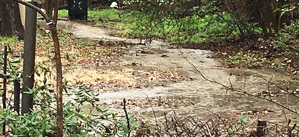
A: Mystery Creek is an ephemeral creek located in the Bird Streets neighborhood of South Austin. It’s one of three remaining short creeks that were once part a larger creek system that existed south of Stassney Lane West of Congress.
Now, the meadow that those creeks were on is full of houses. Four blocks of mystery Creek are all that is left of a bigger water system that once drained an area that spread south, all the way to present day William Cannon.
Q: What the heck is an ephemeral creek?
A: The EPA, describes an ephemeral creek as a body of water that is above the water table and flows during rain events. When it rains, these pop up waterways are in essence, the capillaries of our creek system.
Without them, our creeks won’t function correctly; water won’t flow into the ground and nurture the trees. Instead, It goes into the city’s storm drains or courses through our backyards where It can potentially overwhelm our larger creeks.
Q: why should we care about ephemeral creeks?
A: Without them, all of that stormwater rushes downhill into the city’s storm drain system or Lady Bird Lake, where it can dump, gas oil, fertilizer, industrial runoff or anything that’s in the street into that sensitive environment. It can all end up in Lady Bird Lake.
Ephemeral creeks prevent floods. Small meandering, waterways help gently guide potential flood water through the natural contours of the earth and deposit it where it needs to go; the roots of trees, perennial pools, wetlands, and other habitat features that require water.
When flood water travels unimpeded, it can flood our streets and yards. Erosion is another problem ephemeral creeks help avoid, by lessening the volume of water contributing to the overall amount of water in the creeks.
Q: Where are these Lost Creeks of Austin?
A: they are actually all over Austin. We are used to thinking of town lake as, well..a lake, but in actuality it’s the Colorado river. We live in a section of the Colorado River Valley. If you think of Austin being in a big bowl with the Colorado river in the middle, all the creeks in town run into the river, Bouldin, Waller, Barton; they all run into a larger water system; the Colorado River.
As Austin has grown up over the years, neighborhoods downtown, freeways, huge skyscrapers; have been built in the path that these natural waterways formally took to get to the river.
Many of these features have been permanently cut off or are underneath larger structures, but they still remain. These features are peppered all over town. Smalls springs, seeps and ephemeral creeks are networked all over our neighborhoods. They’ve just never been formally mapped. They’re in essence LOST, but we can find them and protect them.

